In the fall of 2010, OCC completed a shoreline protection project to reduce erosion and restore approximately 570 linear feet of rapidly eroding marsh shoreline on Mordecai Island, a 45 acre uninhabited sedge island, west of Beach Haven (Long Beach Island), New Jersey. This project was the second phase of the South West Mordecai Ecosystem Restoration (SWMER) project. Mordecai and its surrounding waters are within the Jacques Cousteau National Estuarine Research Reserve (JCNERR) and are also listed as Essential Fish Habitat (EFH) for spawning and all life stages of Winter Flounder. It is similarly listed for its essential role in juvenile and adult stages of Atlantic Sea Herring, bluefish, Summer Flounder, Scup and Black Sea Bass.
 |
| Location map for SWMER Phase II |
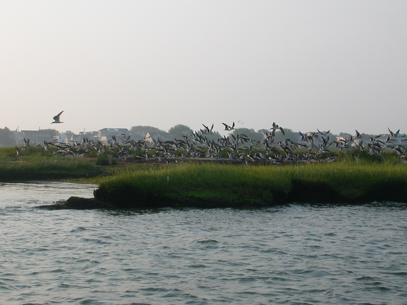
Mordecai is also part of the “Barnegat Bay Complex” (Complex #6) and considered one of the “Significant Habitats and Habitat Complexes of the New York Bight” as designated by the US Fish and Wildlife Service (USFWS). It is very close to the Edwin B. Forsythe National Wildlife Refuge and provides similar habitat to many fish, bird and plant species. Mordecai serves as a strategically important nesting island for many New Jersey Threatened and Endangered Species and contains a large colony of nesting colonial waterbirds. Of particular significance is the approximately 50 pair of State Endangered Black Skimmers. Other State Endangered bird species observed on or near Mordecai include the American Bittern, the Least Tern and the Northern Harrier. State Threatened species include the Black-Crowned Night Heron and the Yellow-Crowned Night Heron.
 |
| Black Skimmers utilizing the valuable habitat on Mordecai Island. |
SWMER Phase I was completed in the summer of 2006 and included the installation of biodegradable coir and jute biologs installed along the shoreline of Mordecai Island along with planting Spartina alternaflora in the biologs as well as on the landward, protected side of the biologs. Biologs were installed along the edge of the shoreline and secured with oak stakes along various lengths of shoreline. While the biologs installed on the eastern, protected shoreline remained intact, the biologs on the western, exposed shoreline, more susceptible to wind and wave erosion, did not last as long.
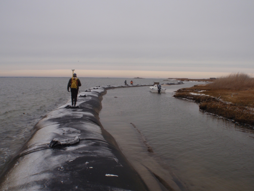
SWMER Phase II consisted of three components, which included 570 linear feet of 22-foot circumference, sand filled geotextile tubes along the south west portion of the island where erosion rates are the highest. When filled, the tubes resulted in approximately 3.5 foot high sill ranging from 10 to 50 feet from the shoreline, and approximately 6 inches below the mean high water line. The preliminary placement of the tubes was determined by performing a GIS analysis of the 1986 island shoreline and final placement approval was a joint effort between OCC, the client, Mordecai Land Trust, U.S Fish and Wildlife Service, the N.J. Department of Environmental Protection and the U.S. Army Corps of Engineers. In addition to the geotextile tubes, 20-inch diameter premium quality biologs were installed behind the geotextile tubes. The purpose of these additional biologs was to determine whether or not they would survive longer and function to protect shoreline, in the lee of the geotextile tubes. The third and final component of the project were experimental coir biologs placed perpendicular to the shoreline along the southern section of shoreline to deflect currents between the island and the adjacent bulkhead. The theory behind this element is that by reducing the currents along this section of the shoreline, erosion would also be reduced.
 |
| Aerial view of island including location of geotextile sill and current deflectors. |
 |
| Cross section of geotextile tube sill. |
The purpose of the tubes is to reduce wave action from boat wake and wind waves that attack this section of the island. Below are photographs of the project, after the geotextile tubes were installed that show the tubes blocking wave energy before making contact with the shoreline. This project will continue to be monitored to not only determine if the tubes are reducing erosion, but if they are also encouraging any sediment accretion.
 |
| Intial placement of the geotextile tubes. |
 |
| Final layout of geotextile tube sill prior to commencement of sand filling. |
 |
| Filled geotextile tube sill during the as-built survey. |
 |
| Installation of 20-inch diameter, premium quality biologs on the lee side of the geotextile tube sill. |
 |
| Installation of the coir biolog current deflectors. |
 |
| Contractor photograph of geotextile tube sill in action. Notice the calm waters on the lee side of the tubes. |


Soil erosion is characterized as the eroding of topsoil. Topsoil is the top layer of soil and is the most prolific in light of the fact that it contains the most natural, supplement rich materials. One of the fundamental driver of soil disintegration is water disintegration, which is the loss of topsoil because of water.
ReplyDeleteErosion Control Company Austin TX